
Slow the segment, not the subdivision.
An NWS warning can't tell dispatch which mileposts need a slow order, and a TV forecast can't tell engineering where the washout risk is tonight. SiteWarn™ maps your subdivisions as corridors and your yards, bridges and trouble spots as points, and live meteorologists watch all of it 24/7/365 — warning by milepost range and time window, with 7-day planning outlooks and days of lead on the wind and heat events that shape the operating plan.
Trusted for 14 years at more than 400 sites in all 50 states, with a 100% client renewal rate.
Customized for a single site — or for a command or operations center monitoring hundreds, even thousands, of sites from one screen.
Why railroads choose SiteWarn
A fully customized program: you set the thresholds, we watch the weather.
Warnings by milepost range, not region
We load your subdivisions as corridors and your yards, bridges, sidings and known washout locations as points. A warning names the segment, the milepost range and the time window, so dispatch issues a slow order or hold for the trains that need it and the rest of the subdivision keeps moving.
Wind at your blow-over thresholds
Empty double-stacks and autoracks don't need a hurricane to leave the rail. You set the crosswind threshold by equipment and by segment; we warn on large-scale wind events days ahead by corridor, and on thunderstorm outflow and gap winds an hour or more ahead of the milepost range affected.
Washout, heat and cold for engineering
Flash-flood and heavy-rain warnings for known washout locations and bridge approaches; rail-temperature guidance for heat-related buckling and slow orders; extreme-cold outlooks for pull-aparts and switch heaters — with a 7-day outlook so maintenance-of-way plans the week around it.
Lead time measured in days for planning
Network operations plan days ahead, so we do too: a 7-day planning outlook by subdivision every morning (10 days on request), watches for large-scale wind, ice and flood events up to 7 days out, warnings by day 5, and short-fuse severe weather still at 60 minutes or more. Delivered to dispatch, engineering and yards through the portal, app, phone, text, email or API into your dispatch system.
What a typical railroad program looks like
Every program is built with network operations, engineering and safety. Here is a common starting point for a regional or short-line railroad; Class I networks repeat it by subdivision and division.
- 7-day planning outlook: issued daily by subdivision, covering wind, heat and cold, flooding and severe weather potential by corridor and day — extendable to 10 days for operating-plan cycles that need it.
- Large-scale high wind: watch issued up to 7 days ahead for the subdivisions and days affected, converted to a warning by 5 days out with onset, peak and end times by milepost range, at your blow-over thresholds by equipment type.
- Thunderstorm wind, tornado and hail on the line: segment-specific warnings with milepost range and time window, 60 minutes or more ahead; null-warning notification when an NWS warning covers a subdivision but the storm won't reach it.
- Flash flooding and washout: warnings for known washout locations, bridge approaches and low segments with expected onset and rainfall amounts; river-flood outlooks days ahead for lines that follow rivers.
- Extreme heat and cold: rail-temperature guidance and heat slow-order windows by subdivision; extreme-cold outlooks for pull-apart risk, switch heaters and crew exposure.
- Yards and crews: lightning alerts for yard, intermodal and maintenance crews (within 10 miles, warning within 5), hail and high-wind warnings for yards, and winter-weather timing for crew and switching decisions.
- Delivery: portal and push alerts for dispatch and network operations, live phone call to the on-duty chief dispatcher for anything train-critical, text and email to engineering, roadmasters and yardmasters — and an API feed into your dispatch or engineering systems so slow-order recommendations land where dispatchers already work.
- Heat (WBGT) for crews: advisories and warnings at your work-rest thresholds for yard and maintenance-of-way crews, alongside the rail-temperature guidance above.
- Wildfire: advisory when fire-weather conditions are expected to threaten the site or its access routes; warning when an active fire's location and expected spread put the site at risk, with timing and an all-clear.
- Hazard Matrix for network operations: your subdivisions grouped into divisions you define — each holding any number of segments, yards and trouble spots — with each division's status for every hazard on one grid, for the chief dispatcher's desk.
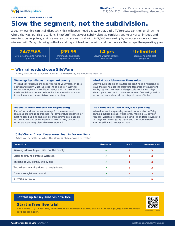
Take the one-page overview with you
Everything on this page on a single sheet — warnings by milepost, blow-over wind thresholds, washout and heat guidance, and how to start a Free Live Trial. Made to forward to network operations or the chief engineer.
"I am very impressed with how SiteWarn has allowed us to keep employees safe and avoid un-needed weather related shutdowns at the same time. The service has paid for itself time and again."
SABIC Plant Safety and Security, Ottawa, IL
"Proactive storm warnings from WeatherGuidance prevented equipment damage and enabled an efficient post-event restoration with minimal risk exposure. We truly appreciate your valuable service!"
Operations team, utility-scale solar plant operator, Texas
Questions railroad operations and engineering teams ask
Can you warn by milepost range instead of by county?
Yes. We map each subdivision as a corridor and warn by segment with the milepost range and the time window in a storm's path, so dispatch issues slow orders or holds only where they're needed.
How far ahead do you warn?
Every subdivision gets a 7-day planning outlook, extendable to 10 days. Large-scale high-wind, ice and flood events are issued as watches up to 7 days out and converted to warnings by 5 days out, with timing by milepost range. Thunderstorm-driven wind, hail and tornadoes are warned 60 minutes or more ahead of the affected segment.
Do you warn on wind for blow-over risk?
Yes. You set the crosswind threshold by equipment type — empty double-stacks, autoracks, empties in general — and by segment where exposure differs. We warn on large-scale wind events days ahead by corridor and on thunderstorm outflow and gap winds an hour or more ahead of the milepost range.
Can you help with washout and heat slow orders?
Yes. Flash-flood and heavy-rain warnings cover known washout locations and bridge approaches with expected onset and amounts, and rail-temperature guidance supports heat slow-order windows by subdivision, with a 7-day outlook so maintenance-of-way can plan the week.
What does the Free Live Trial involve?
Send us your subdivisions (GIS, a track chart, or a list of endpoints and known trouble spots) and your yards. We build the corridors, set thresholds with operations and engineering, and monitor and warn exactly as we would for a paying railroad — no credit card and no obligation.
See it live on your own subdivisions
Not a demo. We load your real subdivisions and yards with your real thresholds and monitor them exactly as we would for a paying railroad.
- 7-day outlooks and live wind, washout, heat and severe weather warnings by milepost for your actual network
- Portal and radar with subdivisions and yards mapped, for dispatch and engineering — API available for dispatch-system integration
- Your thresholds, lead time and delivery methods
- No credit card, no contract, no obligation
Prefer to talk first? Call (512) 504-3151 or email sitewarn@weatherguidance.com during business hours, and we'll get right back to you.
SiteWarn also serves transportation and logistics, electric utilities, construction contractors and more than a dozen other industries. See what the portal and app look like.